Clear the fog on both sides of the Bosphorus
FOG hides the whole world map and reveals only the streets you physically walk. Istanbul gives you two cleared continents separated by water you cannot walk across.
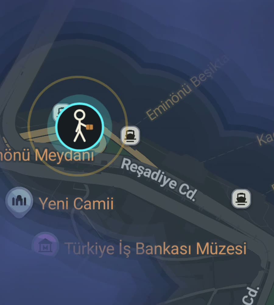
Istanbul on the FOG map, fog burned away along a walked route from Sultanahmet over the Galata Bridge and up through Beyoglu.
The city is steeper than photographs suggest
Istanbul is built on hills, and the walking reflects it. The historic peninsula rises from the Golden Horn in a series of ridges, so a walk from Eminonu up to Suleymaniye or Fatih is a real climb. Across the water, Galata goes up sharply from the bridge to the tower and keeps going toward Istiklal Caddesi. On the Asian side, Kadikoy and Moda are gentler but still rolling.
The street pattern is old and irregular almost everywhere. The peninsula is a knot of narrow lanes that bend, fork and dead-end, laid over Byzantine and Ottoman street lines rather than any plan. Beyoglu is similar. It is the kind of tangle where you will discover streets you did not know existed, which is exactly what makes the fog interesting here. Modern districts further out, like Atasehir or parts of Bakirkoy, are laid out on wider boulevards and feel completely different.
One long afternoon, a lot of map
Start at Sultanahmet Square between the Blue Mosque and Hagia Sophia. Walk west through the small streets to the Grand Bazaar, out its north side, and down the hill through the spice market to Eminonu. Cross the Galata Bridge on foot, which is one of the best short walks in the city, then climb the lanes to Galata Tower.
From there take Istiklal Caddesi north to Taksim Square. If you still have legs, drop east down to Cihangir and follow the shore road along Kabatas toward Besiktas. That single line crosses the Golden Horn, three distinct districts and about two hundred metres of cumulative climb, and it leaves a clean bright arc across the middle of the map.
For the other continent, take a ferry to Kadikoy and walk the Moda coastal path. It is flat, on the water, and clears a long stretch of the Asian shoreline in an hour.
Why the fog behaves oddly here
Istanbul is enormous, roughly fifteen million people spread over both sides of a strait, so no one is finishing this map. What Istanbul rewards instead is density. The old districts have such fine-grained streets that a single afternoon of wandering Balat or Fener or the back lanes of Karakoy clears a genuinely dense patch, not a thin line. It looks like progress because it is.
The Bosphorus creates the strangest effect. Your cleared areas end abruptly at the water on both sides. Ferries do not clear anything useful, since you are not on a street, so the two continents stay visually separate until you have walked enough on each side for them to read as one city. The Golden Horn does the same thing on a smaller scale, and the bridges are the only stitches.
Coverage also runs out fast at the edges. Beyond the inner districts the city becomes highway-scale, and the pedestrian experience drops off quickly.
Practical notes
Seasons. Spring and autumn are the walking seasons. Summer is hot and crowded through the tourist core. Winter brings cold rain off the Black Sea, and occasional snow, and the steep cobbled lanes in Galata get slippery.
Surfaces. A lot of the old city is cobbled or paved with worn stone, often uneven, frequently steep. Shoes matter more here than in most cities.
Positioning. Deep in the covered sections of the Grand Bazaar you are effectively indoors and the position will not be reliable. Out in the open lanes it tracks fine.
FOG keeps revealing with the app closed and the screen off, so you can walk all day without touching the phone. No account, no cloud, no analytics, no ads. The map stays on the device and you can export your data.
Questions people actually ask
Does the ferry crossing clear anything?
Not usefully. FOG reveals where you physically go, and a ferry route across open water is not a street. The Galata Bridge on foot does clear.
Do both European and Asian sides count as Istanbul?
The app shows the percentage of a city you have lit up based on the city's own boundary, so walking Kadikoy contributes the same as walking Beyoglu.
What is included in the paid unlock?
One purchase of USD 5.99 unlocks unlimited ranks, every character, and history import from Google Timeline exports and GPX files. No subscription.
Does FOG need an internet account?
No. There is no account and no sign-up. Nothing is uploaded, and you can export your own data whenever you want.
Start with a dark map.
FOG is free to explore. No account, no subscription, and your map never leaves your phone.
free to explore · one purchase unlocks everything · never a subscription