Walk Nashville and see which parts you actually cover
FOG starts with the entire world hidden under fog. The streets you physically walk are the only ones that clear, and they clear for good.
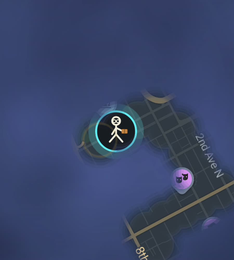
Nashville in FOG, the fog cleared along a walked route from downtown across the pedestrian bridge into East Nashville.
Good pockets, awkward gaps
Nashville is a driving city with several genuinely good walking neighbourhoods dropped into it. Downtown is compact and on a grid: lower Broadway, Second Avenue, Printers Alley, and the numbered avenues running back from the Cumberland River. South of it SoBro and the Gulch are walkable in themselves. Then there are 12South along 12th Avenue South, Hillsboro Village near Vanderbilt, Germantown north of the capitol, and East Nashville around Five Points and Eastland Avenue.
The problem is what sits between them. Charlotte Avenue, 8th Avenue South, Gallatin Pike and the rest are wide, fast and often missing a continuous sidewalk. So the pockets behave like islands, and the map shows it. You get separate lit patches with a lot of grey in between unless you deliberately walk the connectors.
The best afternoon on foot
Start at the Bicentennial Capitol Mall and the farmers market, walk north into Germantown and do the small grid there, then come back down toward the river. Follow the riverfront to the John Seigenthaler Pedestrian Bridge and cross the Cumberland. On the far side you are on the edge of East Nashville, and it is another mile through the neighbourhood streets to Five Points.
Come back over the bridge, drop down onto lower Broadway and walk west through downtown into the Gulch. That is roughly ten kilometres and it strings three separate walkable districts into one continuous line, which is exactly the kind of walk this city rewards. For pure distance, the greenway system is the answer: Shelby Bottoms on the east side, or Richland Creek out west.
Why the fog is slow to clear here
Nashville is spread out and the ground rolls, so the numbers do not build the way they do in a dense old city. A long walk in 12South might light a dozen residential blocks and then stop at an arterial you would rather not walk beside. Cul-de-sac subdivisions further out are worse: you cover distance, you clear one loop, you come back the way you came.
Summer is the other honest limit. From June into September the heat and humidity are heavy, and afternoon thunderstorms arrive with little warning, so morning and evening are when the walking happens. Winter is mild and generally fine. The greenways are the reliable way to keep the numbers moving, and the pedestrian bridge is the one downtown crossing that makes the river stop being a wall.
What FOG does
FOG is a fog of war walking map. The whole world starts under fog and only the streets you physically walk are revealed. They stay revealed. Background exploring keeps it running with the app closed and the screen off, so short walks between errands still count.
Free to explore. One purchase of USD 5.99 unlocks unlimited ranks, every character and history import, with no subscription. Ranks climb with covered area: Wanderer, Scout, Pathfinder, Explorer, Voyager. City percent shows how much of Nashville you have lit. The collection is 241 countries, 3,390 regions and 7,342 named places, and the only way to add one is to physically stand in it.
No account, no sign-up, no cloud, no analytics, no ads, no tracking. The map never leaves the phone and you can export your data.
Questions people actually ask
Does driving reveal streets?
FOG is built for walking, running and riding. In a car city the interesting map is the part you covered under your own power, which is what most people track.
Do the greenways count?
Yes. Shelby Bottoms, Richland Creek and the rest reveal like any other path, and they are the easiest way to add area here.
Can I import old walks?
Yes. History import comes with the USD 5.99 unlock and reads Google Timeline exports and GPX files.
Is there a subscription?
No. Exploring is free, and one purchase of USD 5.99 unlocks the rest permanently.
Start with a dark map.
FOG is free to explore. No account, no subscription, and your map never leaves your phone.
free to explore · one purchase unlocks everything · never a subscription