Clear Vienna ring by ring
FOG starts with the whole world hidden. Walk the first district, the Ring, the long avenue through the Prater, and each of them stays lit for good.
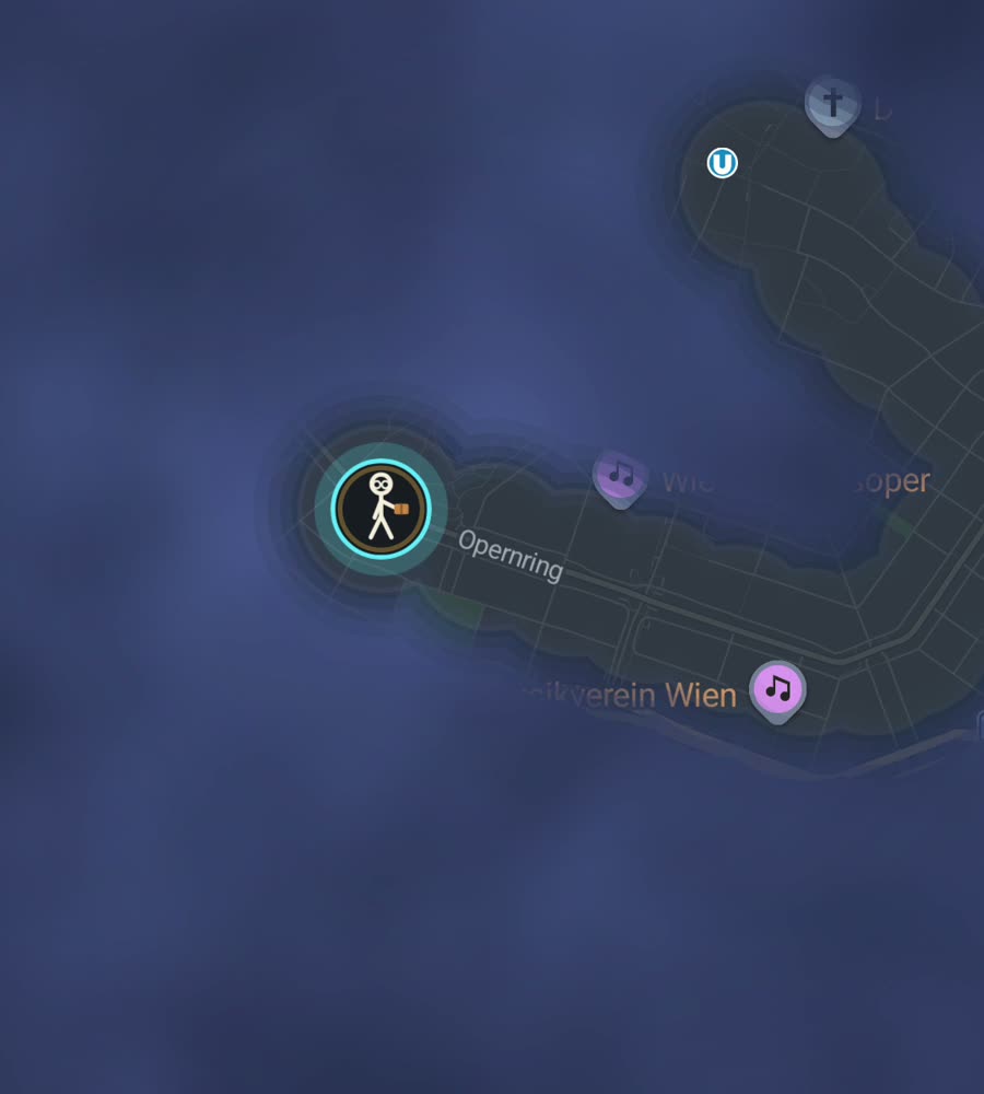
Vienna on the FOG map, the fog burned off along a walked route from Stephansplatz across the Ring to Karlsplatz.
A city built in rings
Vienna is organised as a target. District one, the Innere Stadt, is a medieval tangle of narrow streets around Stephansplatz. Around it runs the Ringstrasse, five kilometres of boulevard laid out where the city walls used to be. Around that sit districts two through nine, and around those runs the Gurtel, the second ring. The district numbering spirals outward, so once you have the pattern you always roughly know where you are.
The eastern half is flat, out across the Danube Canal into Leopoldstadt and on to the Danube itself. The west climbs. Above Ottakring and Dobling the streets tilt up into the Vienna Woods, and Kahlenberg and Grinzing sit high enough that walking out there is a hill walk with a city attached to it.
An afternoon through the middle
Start at Stephansplatz and walk the Graben and Kohlmarkt, then deliberately work the small streets behind them rather than the main lines, because the first district's back lanes are short, dense and fill in quickly. Come out at the Ring, follow it past the Hofburg and the museums to Karlsplatz, then walk the length of the Naschmarkt above the covered Wien river.
From the far end pick up Mariahilfer Strasse and walk it west to the Gurtel, then loop back through the sixth and seventh districts on residential streets. Two to three hours, and it takes you through the tightest and the most regular street patterns in the city in a single continuous line.
The map fills as a bullseye
District one is small and closes fast, which makes Vienna satisfying early on. The inner districts just outside the Ring are nineteenth century blocks: regular, connected, walkable, and easy to sweep street by street. You can watch a whole district go solid over a few weeks of ordinary walking.
Past the Gurtel the pattern loosens. Favoriten, Floridsdorf and Donaustadt spread out with wide roads, housing estates and long gaps between things, and the same effort buys much less lit map. The Prater is its own case. The Hauptallee runs straight for over four kilometres and clears a long line through green with almost no side streets branching off it. The Donauinsel does the same for twenty one kilometres, which is either a good day out or a very thin stripe, depending how you look at it.
Seasons and other details
Winter is grey, cold and dark by late afternoon, and January is not a coverage month here. Spring and autumn are excellent, with long even days and shade along the Ring. Summer gets genuinely hot, which is why people walk the Danube Canal and the tree cover in the Prater in July rather than the open boulevards.
Positioning is generally good. The first district's narrow streets between tall stone buildings are the one place a trail can wobble, and it settles the moment you reach the Ring or an open square. The other practical note is slope. Routes above the Gurtel on the western side climb more than the map suggests, and the paths in the Vienna Woods are hiking rather than strolling.
Questions people actually ask
Does the app have Vienna walking routes in it?
No. FOG has no guides, curated routes or local partnerships. It is one world map under fog, identical everywhere, and your feet are the only thing that clears it.
Do I need to hold the phone out while walking the Ring?
No. Background exploring keeps revealing the map with the app closed and the screen off.
Can I import years of old walking?
Yes, with the paid unlock, from Google Timeline exports and GPX files.
What does the unlock cost?
One purchase of USD 5.99. It unlocks unlimited ranks, every character and history import. Exploring is free and there is no subscription.
What are the ranks?
Ranks climb with the area you have covered: Wanderer, Scout, Pathfinder, Explorer, Voyager. Alongside that, FOG shows a percentage for each city you have walked and tracks 241 countries, 3,390 regions and 7,342 named places.
Start with a dark map.
FOG is free to explore. No account, no subscription, and your map never leaves your phone.
free to explore · one purchase unlocks everything · never a subscription